Ireland weather: Warm spell end date confirmed as snow warning issued amid -17C drop
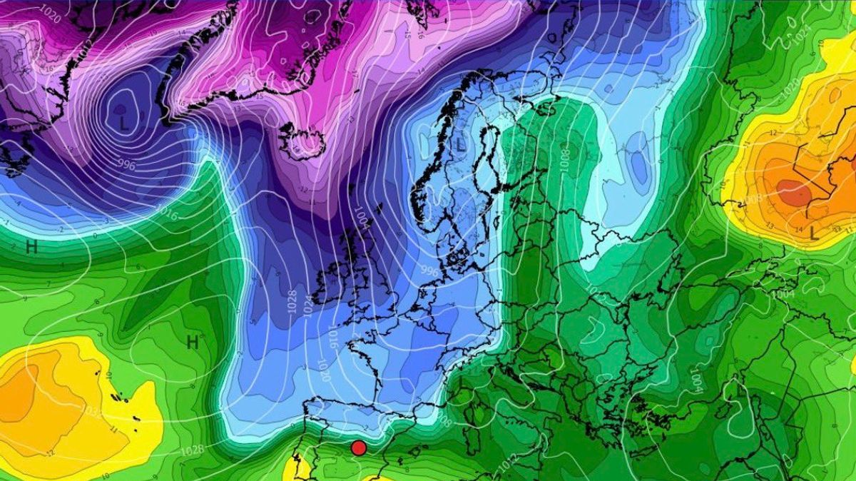
The country has been enjoying a spell of glorious weather over recent days, with the sun shining and the temperatures rising to a balmy 17C.Friday marked the so far as a sudden burst of warm and sunny weather swept over the country.Thankfully, the stunning conditions are set to continue into the weekend, with further spells of dry and sunny weather on the cards across Saturday and Sunday.However, you might want to soak up the sun while you can, as a weather expert has warned that the warm spell will come a dramatic end next week, with temperatures set to plummet below freezing while snowfall is expected in some areas.Alan O'Reilly, the hobbyist meteorologist who runs the popular Carlow Weather social media pages, told his 156,000 followers to expect much cooler conditions next week."Colder next week with some wintry showers. Bad news for the heating bills," he said as he shared images from weather models which showed that temperatures will plummet from Wednesday.Met Eireann's latest forecast also shows a dramatic change in conditions from Wednesday, which is expected to be a wet and windy day. Daytime temperatures are not expected to exceed 9C, while the national forecaster warned that it will colder with the added wind chill from fresh to strong and gusty winds.Met Eireann has said that while there will be plenty of dry weather for the rest of the weekend and the start of next week, it will turn more unsettled and mixed from Monday night and for the rest of the week with some rain and showers on the way.The national forecaster has also warned that it will be much colder too, with some of the showers turning wintry through midweek while it it will also be windy at times.You can check out Met Eireann's forecast for the next few days below.Met Eireann's National OutlookSaturday (March 21): Any mist and fog will quickly clear this morning, though there's the chance of some coastal fog patches lingering in parts. It'll be another dry day for most, with spells of sunshine, hazy at times. It'll be a little cloudier in coastal parts of the northwest, but dry apart from the chance of a few spots of drizzle. Highest temperatures of 11C to 16C in mostly light southwest or variable breezes.Tonight: Dry at first with clear spells and with some patches of mist and fog forming, mainly further south. Cloud will increase from the northwest overnight with a little light rain and drizzle starting to move southeastwards. Lowest temperatures of 0C to 6C degrees, coldest across the south and southeast, in light to moderate southwesterly or variable breezes.Sunday (March 22): Generally cloudy at first tomorrow with a little rain and drizzle moving southeastwards. However, a clearance to mostly dry weather with sunny spells will extend from the northwest to most parts through the morning and afternoon. Highest temperatures of 9C to 14C in light to moderate southwesterly winds, veering northwesterly.Sunday night: Dry with a mix of cloud and clear spells. Lowest temperatures of 1C to 6C in just light variable breezes.Monday (March 23): A largely dry day for most, apart from the odd spot of drizzle, with some hazy spells of sunshine, though it'll become increasingly cloudy with some light rain and drizzle moving into northwestern parts later in the evening. Highest temperatures of 9C to 13C in mostly moderate southwest winds, fresher later in western and northwestern parts.Monday night: A breezy and cloudy night with outbreaks of rain moving southeastwards to most parts. Lowest temperatures of 6C to 9C in moderate to fresh and gusty southwest winds.Tuesday (March 24): Cloudy for a time with further outbreaks of rain, heavy at times. The rain will clear southeastwards by the afternoon, with sunny spells and fairly widespread showers following, some of hail, with the chance of the odd rumble of thunder. A blustery day with highest temperatures of 9C to 12C in fresh and gusty southwesterly winds veering westerly, strong to near gale force and gusty in western coastal parts.Tuesday night: Continuing rather windy and showery, some of the showers turning wintry and with a chance of thunder. Lowest temperatures of 1C to 4C in fresh and gusty westerly winds, strong to near gale force in western coastal parts.Wednesday (March 25): A windy and showery day and some of the showers will be heavy, with a chance of thunder. Some will be wintry too, especially through the morning and again later. There'll be some sunny spells also. Highest temperatures of 7C to 9C, but feeling colder with the added wind chill from fresh to strong and gusty northwest winds, reaching near gale to gale force in western coastal parts.Want to see more of the stories you love from the Irish Mirror? Making us your preferred source on Google means you’ll get more of our exclusives, top stories and must-read content straight away. To add Irish Mirror as a preferred source, simply click here.