Miserable weather to hit as Atlantic low pressure dominates Met Eireann forecast
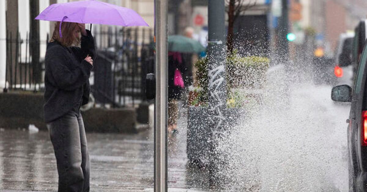
Atlantic low pressure will dominate over the coming days, bringing unsettled and mixed conditionsRain and generally unsettled weather will hit Ireland this week as Atlantic low pressure dominates.Today will be dry for many with bright spells for the midlands and east. It will be cloudier further west with persistent rain over western coastal areas. with some spot flooding possible there too.Highest temperatures of 8 to 12 degrees are forecast, with mostly moderate southerly winds, fresher near Atlantic coasts. It will be cloudy further west tonight with outbreaks of rain and drizzle becoming patchier through the night.A mix of cloud and clear spells further east with just some patches of light rain or drizzle. Some areas of mist and fog will develop too. Lowest temperatures of 2 to 7 degrees are forecast, milder further west where it will be cloudier, with light variable breezes.Tomorrow will have a mix of cloud and bright spells, with some patches of rain or drizzle through the day. Highest temperatures of 8 to 12 degrees are forecast, with light, occasionally moderate, variable breezes.Here is Met Eireann's national outlook for the coming days:Overview"Atlantic low pressure dominating, bringing unsettled and mixed conditions, with spells of wet and breezy weather forecast for the week ahead."Monday night"A mostly cloudy night, it will start off dry for most. However, outbreaks of rain and drizzle will spread eastwards across the country, becoming patchier as they do so. Lowest temperatures of 3 to 7 degrees, with mostly moderate southerly winds."Tuesday"A mostly cloudy day with just limited bright spells and patchy outbreaks of rain and drizzle. More persistent rain will push into the west later in the day. Becoming breezier through the day with moderate southerly winds veering southwesterly and freshening and becoming gusty. Highest temperatures of 10 to 13 degrees."Tuesday night"Wet and breezy for a time with rain from the west spreading eastwards across the country. As the rain clears eastwards, it will be followed by clearer conditions, but with some showers feeding in from the Atlantic. Lowest temperatures of 3 to 8 degrees, with moderate to fresh southwest to west winds."Wednesday"A windy day, it will start off mostly dry with sunny spells. However, scattered showers will develop through the day, becoming more isolated towards evening. Highest temperatures of 9 to 11 degrees, with fresh to strong and gusty southwesterly winds."Thursday"While there is uncertainty in the detail, current indications are for a windy day with widespread showers or more persistent spells of rain. The showers and rain will be heavy at times with a chance of hail and thunder. Highest temperatures of 7 to 10 degrees, with strong and gusty southwesterly winds."Further outlook"Continuing unsettled for the remainder of the week."Want to see more of the stories you love from Dublin Live? Making us your preferred source on Google means you’ll get more of our exclusives, top stories and must-read content straight away. To add Dublin Live as a preferred source, simply click here.