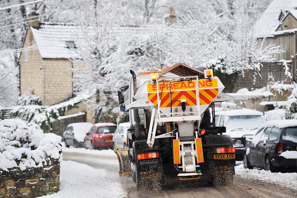
Met Office issues an amber warning for further snow
The Met Office has said that snow will fall on already impacted areas bringing further disruption as more unsettled weather moves in from the west.
A complex mix of snow, heavy rain, strong winds and possibly freezing rain will mark an end to the cold spell that has been in place across the UK since the start of the year.
A low pressure system to the northwest of the UK will drive milder air and strong winds across the UK on Sunday.
With cold air in place across the north, snow is likely to accumulate before turning to rain later on Sunday. For Northern Ireland, Wales and the southern half of England this will largely fall as rain.
Within the Amber warning area in eastern Scotland snow accumulations of 5-15cm are likely at relatively low levels with potentially up to 20-30cm over higher elevations within the Highlands and Aberdeenshire.
A much wider Yellow warning for snow and ice covers the majority of Scotland as well as much of northern England. While snow accumulations are to be lower here, there is still a chance of 2-5cm at low levels and temporarily 10-20 cm over higher ground before snow turns to rain later in the day.
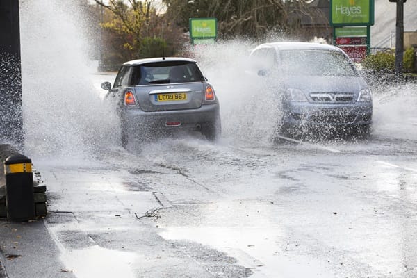
As milder air progresses eastwards, rain becomes more of a hazard, with Yellow rain warnings issued for western and northern Scotland, southwest Scotland and Northern Ireland. 80-100mm of rain could accumulate in the western Scotland warning area through Sunday and into Monday, which along with snow melt could cause some flooding impacts. In Northern Ireland accumulations could reach 40-60mm over higher ground.
As snow transitions to rain there is a risk of some freezing rain for a time, especially across parts of east Scotland and northeast England. Where this occurs, it could lead to ice forming very quickly on all surfaces.
It’ll be a windy day too, with the strongest gusts across Scotland and along the coasts of Northern Ireland. A Yellow warning for wind has been issued, warning for gusts of 45-60mph widely with 70mph gusts possible in the Western Isles and Northern Isles.
Met Office Chief Forecaster, Rebekah Hicks, said: “Sunday will see a disruptive spell of weather as the UK transitions into a milder air mass, marking an end to the cold spell we’ve had since the start of the year. Low pressure will drive milder air in from the west and where this interacts with the cold air, we’ll see notable snow accumulations in already impacted areas of Scotland. Parts of the Highlands could see a further 20-30cm of snow. This will coincide with strong winds, making Sunday an impactful day of weather.
“Snow will turn to rain through the day, with the possibility of freezing rain for a time which could lead to some extremely hazardous conditions with ice forming instantly on all surfaces. With heavy rain and snow melt as temperatures climb, there is a risk of flooding in some areas too.
“With numerous severe weather warnings in place, it is important to stay up to date with the forecast as well as information from local responders and authorities.”
Scottish Justice Secretary, Angela Constance, said: “As we enter a second consecutive weekend of weather warnings with continued snowfall and cold conditions forecast, I appreciate parts of Scotland are still not back to normal. While progress on recovery by partners continues at pace, I again want to thank the public for their patience and understanding that full recovery takes time.
“If anyone affected is isolated or needs help or assistance, they should not hesitate to seek help from their local authority, health board or other public service.
“Warnings for snow and ice are in place across most of Scotland for much of the weekend making driving conditions dangerous and increasing the risk to slips and falls.
“Later on Sunday, snow will start to transition to rain or sleet and flooding impacts are likely in northwest Scotland, with a low risk of minor river and surface water flooding affecting low lying land, roads and properties.
“Taken together, it’s therefore really important for people to continue to plan ahead this weekend and check the range of weather, travel and flooding advice available.
“Ministers will continue to do everything that we can to monitor and manage the situation.”
Pascal Lardet, SEPA Flood Duty Manager, added: “With rainfall forecast to move into south west Scotland on Sunday and then spread north and as temperatures rise following recent cold conditions, rain and thaw of lying snow from Sunday onwards will increase the risk of flooding. Possible impacts could include flooding of low lying land, roads and individual properties. Keep up to date on the latest information by checking our three-day Scottish Flood Forecast .”