Ireland weather forecast: Met Eireann warns of wet weekend before temperatures rise to 23C
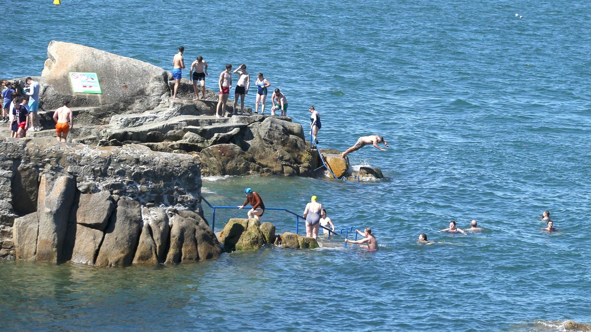
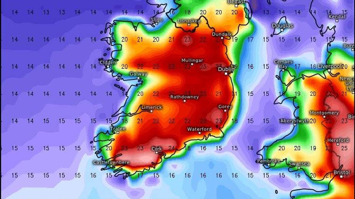
Ireland has been hit by a 'mobile Atlantic regime' in recent days, with wet and windy weather set to continue into next week - but Met Eireann says there is hope for a return to warm and dry conditions with temperatures possibly reaching 23CDespite already being a week into June, there's been no glimpse of summer sunshine as the nation has been hammered by what feels like an endless torrent of wind and rainfall in recent days.A fresh "mobile Atlantic regime" across the country has brought about a prolonged spell of turbulent weather, with rain or showers occurring daily this week, while temperatures have remained below average for this period. The weather is expected to persist on Sunday and throughout next week, with additional bouts of heavy rainfall predicted for the coming days.Nevertheless, there's optimism that we might finally witness the arrival of summer-like conditions in the not too distant future, with Met Éireann identifying precisely when we can anticipate the rain to cease and be succeeded by warm and dry weather.It appears we may also shortly be able to exchange the raincoats and brollies for shorts and sun cream, with the latest predictions showing temperatures climbing to a scorching 23C next week, reports the Irish Mirror.Met Éireann has indicated that "temperatures should improve later in the week," with the national forecaster noting that "currently it looks warmer and drier for Friday with sunny spells".Met Éireann's forecast is supported by the Global Forecast System (GFS), a comprehensive weather prediction model operated by the U.S. National Centers for Environmental Prediction, which indicates temperatures climbing to 23C in parts of the country on Friday. However, one meteorological expert has cautioned that predictions of baking hot weather on Friday should be taken 'with a pinch of salt' as an alternative weather model has suggested temperatures will stay in the mid-teens by next week's end.Alan O'Reilly, who runs the well-known @CarlowWeather account on X, informed his followers on Sunday: "A damp morning and turning very wet again this evening. Also GFS model going for a warm Friday but ECMWF model having none of it so take any promises for warm Friday with a pinch of salt for now."Based on Met Éireann's most recent forecast, Sunday is set to bring another soggy, overcast and blustery day, with "persistent and heavy, spreading across the country through the morning and afternoon".Dry spells are anticipated in the west later in the day, though the rainfall is predicted to persist into the evening across eastern areas.Monday will kick off bright and dry before giving way to widespread bouts of rain, with additional showers forecast for Tuesday, Wednesday and Thursday.Met Éireann National OutlookSunday (June 7)A mostly cloudy day with outbreaks of rain, some of which will be persistent and heavy, spreading across the country through the morning and afternoon. Drier and brighter conditions will develop in the west this evening. However, it will remain wet in eastern parts with some heavy downpours. Highest temperatures of 13C to 17C in moderate to fresh southwest winds, easing in the west later. Tonight: Outbreaks of rain and drizzle in the east will linger for a time early in the night before clearing out over the Irish Sea. Drier and clearer conditions will spread from the west, with a handful of light showers emerging in western areas later on. Temperatures will dip to between 5C and 9C, with light to moderate south-westerly to westerly winds. Some patches of mist are also expected to form.Monday (June 8)The week gets off to a bright start on Monday, with a combination of sunshine and showers. Showers will become increasingly widespread as the day progresses, turning heavy at times, particularly across the north. Temperatures will peak at between 12C and 16C, with moderate west to south-westerly winds and fresher conditions along western coastlines.Tuesday (June 9)Tuesday will bring a mix of showers and sunny spells, with some again turning heavy and a chance of thunder. Top temperatures will range from 13C to 16C, warmest in the south-east, with moderate west to north-westerly winds and fresher conditions on exposed coastlines.Want to see more of the stories you love from Dublin Live? Making us your preferred source on Google means you’ll get more of our exclusives, top stories and must-read content straight away. To add Dublin Live as a preferred source, simply click here.Join our Dublin Live breaking news service on WhatsApp. Click this link to receive your daily dose of Dublin Live content.We also treat our community members to special offers, promotions, and adverts from us and our partners. If you don’t like our community, you can check out any time you like. If you’re curious, you can read our Privacy Notice