How to stay up to date with river levels, flood risk and forecasts
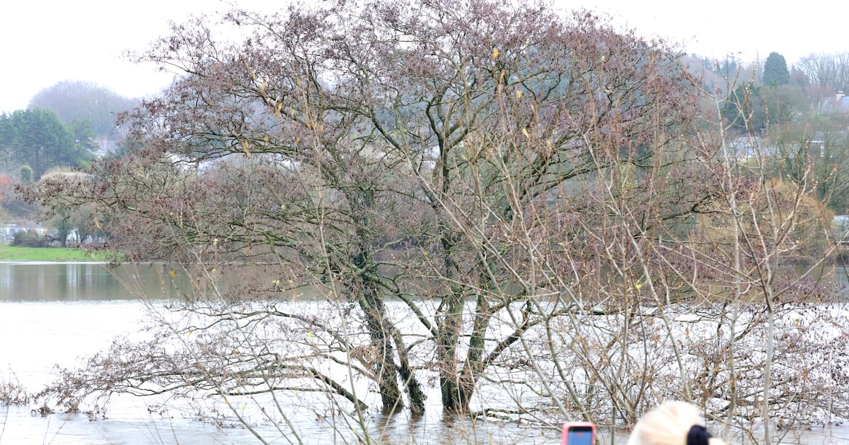
The past week has shown the importance of having good information on flood risk, sharing it well and acting on it promptly. Authorities have encouraged people to stay aware of the weather forecast and water levels in their area amid heavy rain and flooding in places. Here is where to look.Where do I start to find information? Met Éireann is a good place to begin because flooding is usually a result of rain and/or wind and the forecaster advises what’s coming down the track. The forecaster’s website, met.ie, provides national and regional forecasts. You can also get the state of play at your nearest weather station, though there are only 25 of them, so your nearest may actually be quite a distance away. The Met Éireann app is better as it provides more localised information and a look-ahead to the next five days. You can set it to default to your area or zoom in on a map to any location. READ MOREPope apologises to Blackrock College abuse survivors David Ryan and his late brother Mark ‘How dare you’: South Dublin residents vent at plan to redesignate golf amenities for housing Five Irish restaurants awarded Bib Gourmands ahead of Michelin ceremonyHow moving to France has drastically changed my Irish attitude to drinkingHowever, it does not give detailed information about river levels or ground conditions, and forecasts will carry general warnings such as “flooding possible in coastal areas”, “potential of flooding on low ground near rivers”, “concerns around high river levels at high tide” etc, so you really need to already know your underlying flood risk. So how do I know that? The Office of Public Works (OPW) maintains the website floodinfo.ie but it requires setting aside a serious amount of time for some high-concentration homework to go through the various maps, charts and databases to work out what applies to a given area. The Slaney river near Bunclody, Wexford as Met Eireann has issued an updated Status Yellow weather warning amid 'uncertainty' over rain following Storm Chandra. A section that lists all the various flood relief schemes proposed, approved, in design and under construction is relatively easy to follow, but this is not a site for accessing immediate information about current conditions. Where can I get that information? It has another website, waterlevel.ie, with real-time data on river levels being fed in from a network of hydrometric stations with gauges at key points along each river. There are seven along the Slaney, for example, with three in Enniscorthy. You can zoom in on a map, pick a station and get charts showing current water levels and past water levels with indicators showing all-time highs and average flood heights, although some measurements only go back a few years. This is also a site to be explored when time allows, rather than in a flood risk emergency. Also, high water levels do not always cause flooding as tides, winds and ground conditions all play a part. Who will make sense of the data for me? All this information, and much more, is analysed by Met Éireann and relayed to local authorities for dissemination to the people and communities at risk. They use local radio and social media for messages and send roads and engineering crews out with signage and road closure warnings, but much depends on whether people are hearing and seeing this activity. A wet week in Irish politicsMost local authorities use the mapalerter.ie website and app to send notices to individuals about issues in their area but you have to sign up for it. Then you’ll get notices via text message, app notification and/or email. It’s a useful but crowded system, with notices issued for everything from water supply disruption to roadworks to flood risk. And the flood risk is still based largely on water levels. It’s not a simple, clear, visually intuitive service that will tell people straight away what the risk level is and how fast they need to act. Is there a site, app or service that will do that? We’re told it’s being worked on – and that it may be worked on a little faster after the trauma of the last week.