When will Storm Floris reach Ireland?
Storm Floris is set to bring unseasonably windy weather and heavy rain for most of the country.
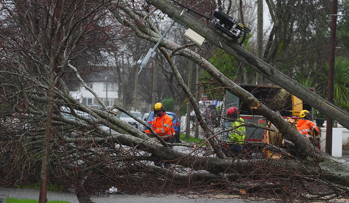
The storm is set to wreak havoc on the northwest of the country over the bank holiday weekend, with Met Éireann warning of dangerous travelling conditions, structural damage and fallen trees, and power outages.
Weather bosses have issued status yellow wind warnings. The wind warning for Clare, Galway, Sligo and Mayo will be active from 2am to 1pm on Monday, and 4am to 4pm for Cavan, Donegal, Monaghan and Leitrim. A status yellow rain warning will be in place for Donegal, Galway, Leitrim, Mayo and Sligo from 2am to 10am.
Storm Floris is set to land in Ireland on Sunday (August 3), with unseasonably high winds and heavy rainfall. Pic: Stephen Collins/Collins Photos
The storm hasn’t formed yet, but is expected to reach Ireland on Sunday night (August 3) and into Bank Holiday Monday (August 4).
The storm has developed through Friday from a frontal wave that is currently lying to the south of Nova Scotia, with an unusually strong jet stream for the time of year carrying the system toward Ireland as it deepens rapidly.
After being named by the Met Office in the UK, a weather advisory has been issued for the country.
Forecaster Andrew Doran-Sherlock warned of the system, saying ‘Storm Floris will bring a spell of wet and unseasonably windy weather, particularly for northwestern areas, through Sunday night and into Monday.
‘However, there is still some uncertainty in the details so the full impacts of the system cannot yet be determined. By Saturday though, the event will be within the range of our high-resolution DINI forecasting model and warnings will be issued.’
With outdoor events such as All Together Now happening this weekend, Mr Doran-Sherlock has said that the advisory is necessary, saying ‘as this is a Bank Holiday Weekend with a large number of outdoor events and with many people going camping, etc, and with an increased usage of temporary structures such as tents, more people will be at a greater risk of exposure than would normally be the case.’
A weather advisory has been issued ahead of official warnings due to a number of outdoor events happening. Pic: Brian Lawless/PA Wire/PA Images
‘And while we are in a period of neap tides, with lowest tidal ranges of this cycle expected on Sunday and Monday, strong onshore winds and high waves may cause wave overtopping in low-lying coastal areas in the northwest and west.’
Meteorologist Alan O’Reilly of Carlow Weather also showed a model of how the storm will go through the country, saying that the strongest gusts will be in northern parts of the country, with the rain moving quickly across the country before clearing east by lunchtime on Monday.