Met Eireann issues Storm Floris warnings for bank holiday
Storm Floris is arriving into Ireland just in time to wreak a bit of havoc on the end of the August Bank Holiday weekend.
The storm is set to move in over the northwest of Ireland late on Sunday night, with ‘unseasonably strong winds’ and ‘heavy rainfall’ occurring through to Monday afternoon.
Met Éireann has issued a weather advisory but as they don’t issue actual warnings more than three days in advance, an official warning will be issued on Saturday.
Met Éireann will issue warnings on Saturday. Pic: Stephen Collins/Collins Photos
The national forecaster is asking that ‘people pay particular attention to the information and advice, and take them into consideration for any planned activities’.
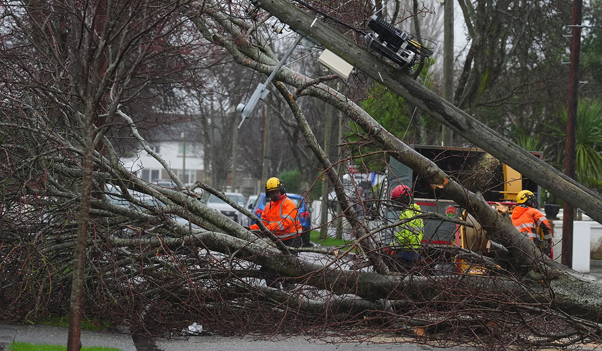
Some potential impacts of the storm include dangerous travel conditions, knock on impacts for outdoor events, structural damage, fallen trees and debris, power outages, waves overtopping and localised floods.
Storm Floris, which has currently not yet formed, is expected to develop through Friday from a frontal wave, currently lying to the south of Nova Scotia.
An unusually strong jet stream for this time of year will carry the system towards Ireland through the weekend, with the storm deepening rapidly.
The storm will arrive on Sunday night. Pic: Collins Photos
Forecaster Andrew Doran-Sherlock said: ‘Storm Floris will bring a spell of wet and unseasonably windy weather, particularly for northwestern areas, through Sunday night and into Monday.
‘However, there is still some uncertainty in the details so the full impacts of the system cannot yet be determined’.
‘By Saturday though, the event will be within the range of our high-resolution DINI forecasting model and warnings will be issued’.
‘However, as this is a Bank Holiday Weekend with a large number of outdoor events and with many people going camping, etc, and with an increased usage of temporary structures such as tents, more people will be at a greater risk of exposure than would normally be the case.
‘And while we are in a period of neap tides, with lowest tidal ranges of this cycle expected on Sunday and Monday, strong onshore winds and high waves may cause wave overtopping in low-lying coastal areas in the northwest and west.’
The Bank Holiday weekend has already caused problems with Gardai appealling to motorists to slow down, take your time getting to your destination, and put the mobile phones away for the duration of your journey.
Gardai have handed out hundreds of fines to motorists using mobile phones while driving over the past week, and all have been issued with a €120 fine and three penalty points on their licence.
In one area of the country, Gardai seized 116 vehicles for breaches of various road traffic laws, in the space of less than 19 hours, that’s more than 6 cars an hour, and, of these, 63 of the drivers had no insurance, and Gardai have taken to social media, notably their official Garda Instagram Page to highlight the issue of road safety.
All roads across the country will see an increase in Garda patrols and checkpoints and motorists are being urged to take extra care as the roads will be especially busy from this evening (Friday) and again on Monday afternoon and evening as the bank holiday weekend draws to a close.
Airports and Railway stations are also seeing a surge in travellers leaving cities and towns and heading away for the long weekend, and Shannon airport has announced it is extremely busy in their carpark with the amount of people jetting off, so booking a car parking space if you intend to fly from Shannon airport is very advisable.