Ireland weather: Expert pinpoints exact date temperatures could hit 30C as heatwave hopes soar
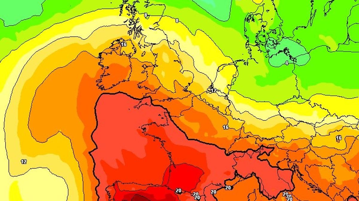
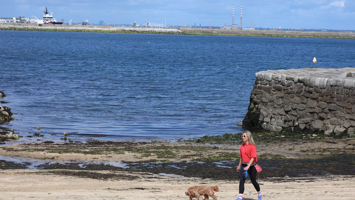
Ireland could be facing into another heatwave according to weather experts, who have revealed that the latest forecasts show temperatures soaring to 30C in just a matter of days.Ireland endured record-breaking heat last month as the record for the hottest day in May was broken by more than 2C as the mercury climbed to 30.5C at Shannon Airport on May 26.Since then, the country has been hit by spells of wind and rain, with little sign of the proverbial 'Leaving Cert' weather typically expected at the start of June.However, it seems the best of the summer weather could be still to come, with a leading meteorologist revealing that the latest forecast show a surge in temperatures later this month.According to Alan O'Reilly, who mans the popular @CarlowWeather account on X, the latest updates from from both The European Centre for Medium-Range Weather Forecasts (ECMWF) and the Global Forecast System (GFS) show temperatures surging in Ireland from around Thursday, June 25.Both forecast suggest the thermometer could hit 30C, sparking hopes that Ireland could be set to bask in another heatwave.O'Reilly said that while the forecast may be "very very uncertain" this far out, the fact both weather models show similar readings could mean that a sudden heat surge is on the way.In a message shared with his 157,000 followers on Sunday, O'Reilly said: "The last few weather model updates have shown a blast of very warm air moving up around the 25th."This far out it is very very uncertain but interesting both models have shown it as a possible outcome."Could see us hit 30c again 'if' it did happen."Looking at the forecast for Sunday and the start of next week, O'Reilly said we can expect some nice hazy sunshine today and a nice start to Monday too.O'Reilly said that cloud will increase from the Southwest Monday morning but rainfall amounts will remain generally very low with odd shower and some patchy drizzle, while Tuesday will see showers push into Southwest in afternoon.According to Met Eireann, temperatures will climb to 22C today, with the best of the warm weather in the West and Midwest.After a warm and sunny Sunday, the national forecaster warned that it'll be more changeable and mixed for the rest of the working week with spells of rain or showers, and with some heavier falls likely in places at times.However, Met Eireann said there will be some drier, brighter spells too and it'll remain mild or warm with temperatures around average for the time of year.Met Eireann National LoutlookSunday (June 14): Mainly dry today, with warm spells of hazy sunshine developing. A little cloudier at first, especially in northern parts, where is the chance of the odd spot of drizzle. Highest temperatures of 17C to 22C generally, warmest in the West and Midwest, but a little cooler near Eastern and some Southern and Northern coasts due to a light to moderate easterly breeze, with those winds likely a little fresher along Southwestern coastal parts.Tonight: Dry for most tonight with a mix of cloud and clear spells. It'll become a cloudier generally later in the night in the southwest with the odd spot of drizzle possible in southwestern parts of Cork and Kerry. There's also the chance of a few showers in the East. Lowest temperatures of 9C to 12C in light to moderate easterly or variable breezes.Monday (June 15): Tomorrow, Monday, will continue to bring a good lot of dry weather to many areas, with some hazy spells of sunshine for a time, but becoming rather cloudy from the West through the morning. A few showers are possible in the morning across parts of the East and North, while a little bit of mostly patchy light rain or drizzle will gradually spread from the southwest, mainly through the afternoon and evening, but amounts should be fairly minimal for most. There is the chance of more moderate showery falls of rain later in parts of the North and with a chance in the East too. There'll be a little hill and coastal mist and fog at times in the South and West. Highest temperatures of 15C to 19C or 20C , warmest across the Midlands and East, in light to moderate mainly east to southeasterly or variable breezes, gradually veering southwesterly for most.Monday night: Showery outbreaks of rain in the north and east for a time will clear northeastwards, with a mix of cloud and clear spells following. However, cloud will continue to increase from the southwest and west, with further scattered outbreaks of mostly light rain and drizzle, starting to spread eastwards from the southwest and west, along with some hill and coastal mist and fog. Lowest temperatures of 10C to 13C in light to moderate southerly winds.Tuesday (June 16): Tuesday will be mostly cloudy for a time, with scattered outbreaks of mostly light rain and drizzle continuing to spread eastwards through the morning, while drier weather will follow from the west for a time. However, through the afternoon, further outbreaks of rain and drizzle will move up from the southwest, mainly over parts of Munster and Leinster and some of that will be heavy, especially in southern parts. There'll be some hill and coastal mist and fog too. Highest temperatures of 15C to 20C in moderate to fresh south to southwest winds.Tuesday night: The rain will likely push further northwards on Tuesday night, heavy at times, before clearing eastwards, with clear spells and isolated showers to follow, mainly into western parts. Lowest temperatures of 10C to 13C in light to moderate southwest winds, fresher in the west.Want to see more of the stories you love from the Irish Mirror? Making us your preferred source on Google means you’ll get more of our exclusives, top stories and must-read content straight away. To add Irish Mirror as a preferred source, simply click here.