Met Éireann issues Status Orange rain and thunderstorm warnings with risk of flooding
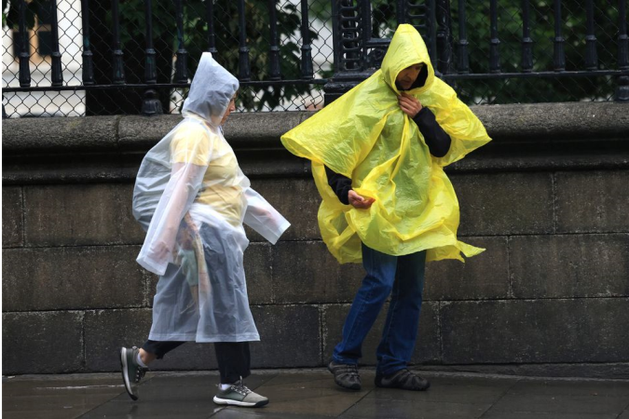
Met Éireann has issued a Status Orange rain and thunderstorm warning for four counties tomorrow with risk of widespread surface flooding.The alert, covering counties Dublin, Louth, Meath and Wicklow came into force at midnight on Monday and will last until 2pm.Impacts include “very difficult” travelling conditions, lightning damage and “very poor” visibility.A Status Yellow rain warning is also in place for Kildare and Monaghan from midnight on Monday until 2pm.The national forecaster said potential impacts include localised flooding, poor visibility and difficult travelling conditions.Some employers have told employees to work from home where possible to avoid travelling.Meanwhile, the UK Met Office issued a Status Yellow rain warning for Antrim, Armagh and Down between 6pm Sunday and 6pm on Monday. A Status Amber/Orange rain warning has also been issued for Antrim, Armagh and Down from 11pm on Sunday until 8am on Monday.There will be scattered heavy showers and longer spells of rain, especially across parts of the midlands and mid-west this evening.However, temperatures of 17 to 22 degrees are expected before another rather damp night tonight, with rain heaviest across the east of the country as temperatures hit lows of 13 to 15 degrees.The new week will start with further showers, heaviest over parts of Leinster and east Ulster with spot flooding possible before conditions brighten in parts of the west and south tomorrow evening.Highest temperatures of 15 to 20 degrees are expected, before another mild and rather wet day on Tuesday when temperatures hit highs of 16 to 19 degrees despite widespread showers in the afternoon.Met Éireann expects the coming days to feature “generally mixed conditions” to start the week, forecasting “showers or longer spells of, at times heavy, rain with spot flooding possible”.There will be fewer showers by midweek.Sunny spells and scattered showers are expected on Wednesday, with rain becoming less heavy than previous days and more isolated by evening as highs of 15 to 19 degrees are forecast.A largely dry day is on the cards for the Thursday, broken by a few light showers as highs hit between 17 to 20 degrees.Met Éireann says an “Atlantic westerly regime looks set to dominate” for the days that follow."The best of the drier and brighter weather will be in the east and south with cloudier conditions and a greater chance of rain or showers as well as breezier conditions in the west and north,” they said."Temperatures look set to remain close to the seasonal norm.”Maeve McTaggart