UK snow bomb to last 'three days' with four counties in England in firing line
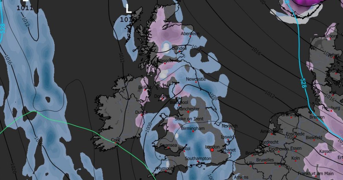
UK snow bomb to last 'three days' with four counties in England in firing lineThe UK snow bomb will last three days - with the exact hour flurries will be heaviest in England announced - ahead of the weekend's downturn in conditions.Forecasts from WX Charts, which uses MetDesk data, suggest that between Friday, December 5, and Sunday, December 7, snow is likely. The maps, which are based on the GFS modelling system, show snow could be heaviest and worst at around 3am on Saturday, December 6.Areas at risk in England include Northumberland, County Durham, North Yorkshire and West Yorkshire in England. In Scotland, Aberdeenshire, Moray, Highland, Angus, Perth and Kinross, and Stirling are the counties most likely to see snow.READ MORE Warning for all UK households who have artificial grassBeyond Monday’s disruptive weather for many, a changeable week of weather is on the cards for many, with low pressure continuing to influence the forecast through much of the period and a mixture of rain, showers and some sunny spells at times, the Met Office has said.James Madden, from Exacta Weather, said: "The unsettled weather conditions (rain and wind) from overnight and some quite heavy rain showers have worked or are still working eastwards and started by crossing over many parts of Ireland and then into northern and western parts of the country to begin."Some of these heavy rain showers in short periods could still also bring the risk of some possible flash flooding in places today, before reducing significantly as they move away from western areas and work eastwards from around early to midday today."Additionally, some of these showers or heavy showers may also consist of hail or even some heavy hail and with accompanying breezy/windy conditions."In addition to some overnight and early today snow in parts of the far north and Scotland, some further snow-forming conditions are also likely in some parts of Scotland and the far north across higher ground once again during this evening (Monday) and early Tuesday."Met Office Chief Forecaster Rebekah Hicks said: “Heavy rain will move over south Wales from late Sunday and through Monday. Whilst rainfall amounts will vary, the largest accumulations are expected over the highest ground in south Wales and could reach 100-120mm through the day. 60-80mm is most likely for many hills within the Amber warning area, while those to lower levels should see around 20-40mm through the day.“Wider yellow warnings for rain have also been issued for the southwest and northwest of England, central and northern parts of Wales, as well as southwest Scotland, with disruption also possible in these areas through the day.”